
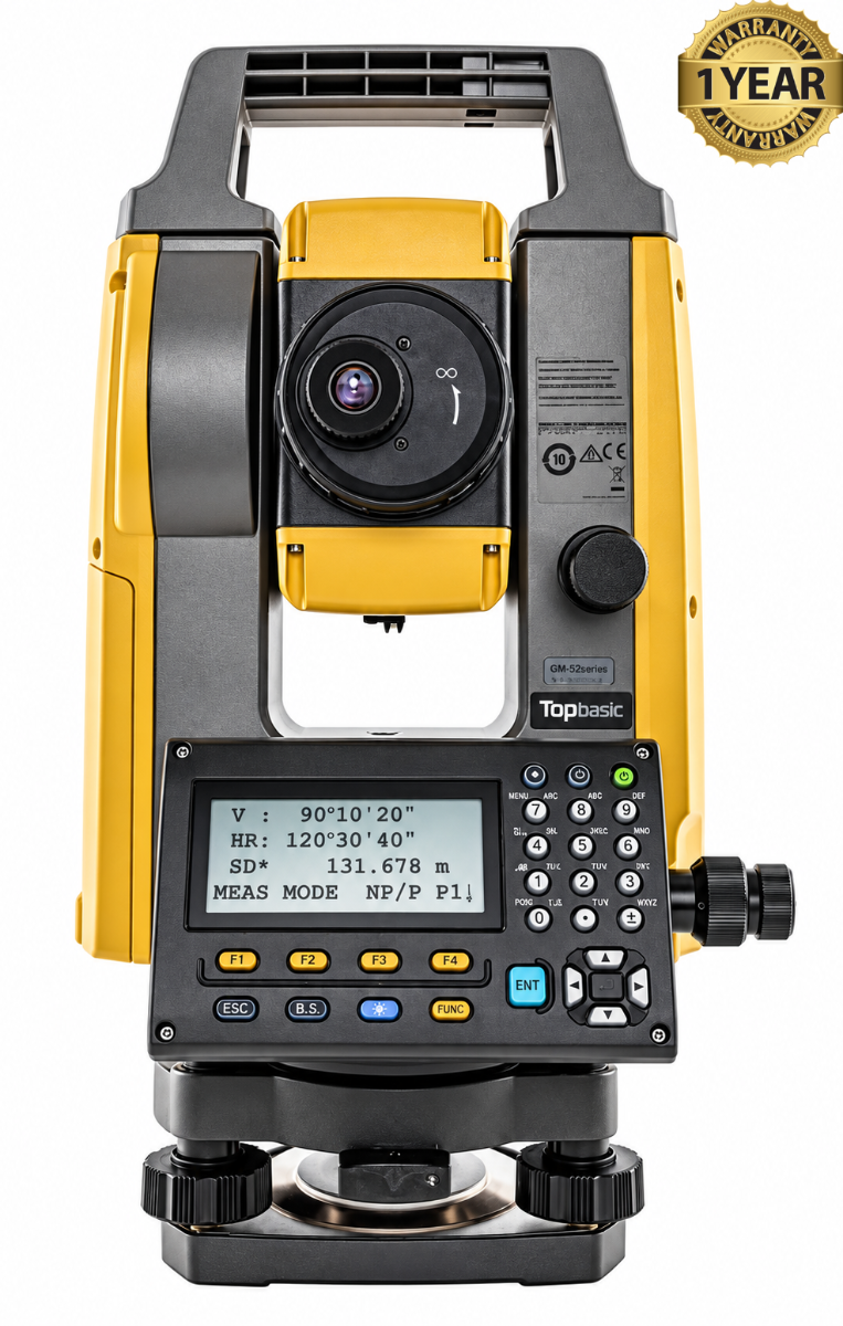

Topcon GM-52 2" Total Station
Condition: Refurbished / Calibrated
Warranty: 1 YEAR WARRANTY
Shipping: USA & Worldwide
|
* Topcon GM-52 2" Total Station (BC# L/T*) |
Topcon GM-52 2" Total Station
The Topcon GM-52 2″ Total Station is a manual surveying instrument used to measure horizontal angles, vertical angles, and distances. It combines these measurements to determine coordinates and elevations, helping surveyors and construction crews document site conditions and position planned features. It is part of Topcon’s GM-50 Series, designed for site surveying, staking, and construction layout.
The 2″ designation means two-arcsecond angular accuracy, describing its precision when measuring angles. Operators manually aim the telescope at a prism or visible surface before taking measurements. This makes the GM-52 suitable for work such as locating survey points, checking alignments, and establishing building positions.
Its electronic distance measurement system provides a range of up to 4,000 meters using a standard prism and up to 500 meters in reflectorless mode, under specified conditions. Reflectorless measurement allows crews to observe surfaces without placing a prism directly on them. Topcon specifies distance accuracy of 1.5 mm + 2 ppm with a prism and 2 mm + 2 ppm in reflectorless mode.
The GM-52 includes backlit displays on both faces of the instrument, allowing convenient operation in either telescope position. Internal memory stores approximately 50,000 points, while USB connectivity supports data transfer. Optional Bluetooth communication enables wireless connection to a compatible data controller.
Built for outdoor fieldwork, the GM-52 has IP66 dust and water protection and a stated battery operating time of approximately 14 hours under specified conditions. Its combination of precise angle measurement, prism and reflectorless ranging, and onboard storage makes it a practical tool for routine surveying and construction measurement.
Features:
- Two-arcsecond (2″) angular accuracy for horizontal and vertical measurements.
- Manual telescope aiming for surveying and construction layout.
- Prism measurement range up to 4,000 meters.
- Reflectorless measurement range up to 500 meters.
- Prism distance accuracy of 1.5 mm + 2 ppm.
- Reflectorless distance accuracy of 2 mm + 2 ppm.
- Visible red laser pointer to help identify measurement locations.
- Dual-face, backlit LCD displays for operation from either side.
- Internal storage for approximately 50,000 points.
- USB connectivity for transferring survey data.
- Optional Bluetooth communication with compatible data controllers.
- Rechargeable battery operation up to approximately 14 hours.
- IP66 dust and water protection.
- Compact, portable design for field use.
- Support for coordinate measurement, elevation checks, and stakeout tasks.
| Specification | Details |
|---|---|
| Manufacturer | Topcon |
| Model | GM-52 |
| Product series | GM-50 Series |
| Instrument type | Manual reflectorless total station |
| Primary applications | Surveying, construction layout, stakeout, and site measurement |
| Horizontal angular accuracy | 2 arcseconds (2″) |
| Vertical angular accuracy | 2 arcseconds (2″) |
| Instrument aiming | Manual |
| Measurements | Horizontal angles, vertical angles, and distances |
| Position calculations | Coordinates and elevations |
| Prism measurement range | Up to 4,000 m under specified conditions |
| Reflectorless measurement range | Up to 500 m under specified conditions |
| Prism distance accuracy | 1.5 mm + 2 ppm |
| Reflectorless distance accuracy | 2 mm + 2 ppm |
| Laser pointer | Visible red laser |
| Displays | Dual-face graphic, backlit LCD |
| Internal memory | Approximately 50,000 points |
| USB connection | USB 2.0 for data transfer |
| Bluetooth | Optional; verify installed configuration |
| Battery | Rechargeable battery |
| Stated operating time | Approximately 14 hours under specified conditions |
| Dust and water protection | IP66 |
| Typical field tasks | Point collection, alignment checks, elevation checks, and setting out design positions |