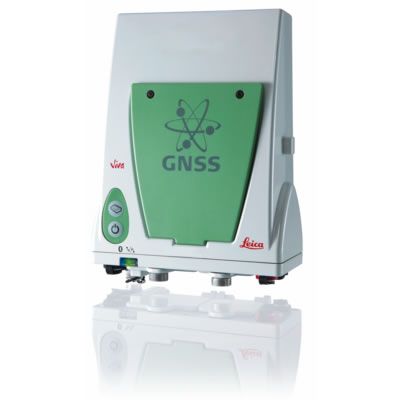


Leica Viva GS10 GNSS Receiver
Condition: Refurbished
Warranty: 1 YEAR WARRANTY
Shipping: USA & Worldwide
Leica Viva GS10 GNSS Receiver
Built on years of knowledge and experence, the Leica GS10 delivers the hallmarks of Leica GNSS – reliability and accuracy.
- Leica SmartCheck – RTK data-processing to guarantee correct resultsLeica SmartTrack – advanced four constellation tracking of all GNSS satellites today and tomorrow
- Leica SmartTrack – advanced four constellation tracking of all GNSS satellites today and tomorrow
- Leica xRTK – delivers more positions in difficult environments.
The Leica GS10 is designed to suit any surveying task.
- Exchangeable communication devices for field base stations and RTK rovers with removable SIM cards
- Fully scalable sensor allows you to buy only what you need today and upgrade with additional functionality as you need it
- Integrated web server to configure the logging of Leica or RINEX raw data and measure with one button press in the field
The Leica GS10 is built for the most demanding environments
- IP68 protection against dust and continuous immersion
- Built for extreme temperatures of -40° C to +65° C
Specifications:
| GNSS technology | Leica patented SmartTrack technology: • Advanced measurement engine • Jamming resistant measurements • High precision pulse aperture multipath correlator for pseudorange measurements • Excellent low elevation tracking • Very low noise GNSS carrier phase measurements with <0.5 mm precision • Minimum acquisition time |
|
| No. of channels | 120 channels | |
| Max. simultaneous tracked satellites | Up to 60 Satellites simultaneously on two frequencies | |
| Satellite signals tracking | • GPS: L1, L2, L2C, L5 • GLONASS: L1, L2 • Galileo (Test): GIOVE-A, GIOVE-B • Galileo: E1, E5a, E5b, Alt-BOC • BeiDou: B1, B2 • SBAS: WAAS, EGNOS, GAGAN, MSAS, QZSS |
|
| GNSS measurements | Fully independent code and phase measurements of all frequencies • GPS: carrier phase full wave length, Code (C/A, P, C Code) • GLONASS: carrier phase full wave length, Code (C/A, P narrow Code) • Galileo: carrier phase full wave length, Code • BeiDou: carrier phase full wave length, Code |
|
| Reacquisition time | <1 sec | |
| Standard survey antennas | ||
| Types | AS10 | AS05 |
| GNSS technology | SmartTrack | SmartTrack |
| Satellite signal tracking | GPS: L1, L2, L5 GLONASS, Galileo, BeiDou | GPS: L1 Glonass, BeiDou: B1 |
| Ground plane | Built-In Ground plane | Built-In Ground plane |
| Dimensions (diameter x height) | 170 mm x 62 mm | 170 mm x 62 mm |
| Weight | 0.44 kg | 0.44 kg |
| Gain | 29±3 dbi | Typically 27 dbi |
| Temperature operating | –40° C to +70° C | |
| Temperature storage | –55° C to +85° C | |
| Humidity | 100% | |
| Protection against water, sand | IP68 according IEC60529 and MIL STD 810F – 506.4-I, MIL STD 810F – 510.4-I and MIL STD 810F – 512.4-I | |
| Drops & topple over | Withstands 1.5 m drop onto hard surfaces and survives topple over from a 2 m pole onto hard surfaces | |
| Vibration | Withstands vibrations during operation on large civil construction machines Compliance with ISO9022-36-08 and MIL-STD 810F – 514.5-Cat24 |
|
| Choke-ring antennas | ||
| Types | AR25 | |
| Satellite signal tracking | GPS: L1, L2, L5 GLONASS, Galileo, BeiDou | |
| Design | Dorne Margolin, JPL design | |
| Protection radome | optional | |
| Dimensions (diameter x height) | 380 mm x 200 mm | |
| Weight | 7.6 kg | |
| Gain | typically 40 dbi | |
| Accuracy (rms) Code differential with DGPS / RTCM | ||
| DGPS / RTCM | Typically 25 cm (rms) | |
| Accuracy (rms) with Real-Time (RTK) | ||
| Standard of compliance | Compliance with ISO17123-8 | |
| Rapid static (phase) Static mode after initialization |
Horizontal: 5 mm + 0.5 ppm (rms) Vertical: 10 mm + 0.5 ppm (rms) |
|
| Kinematic (phase) Moving mode after initialization |
Horizontal: 10 mm + 1 ppm (rms) Vertical: 20 mm + 1 ppm (rms) |
|
| Accuracy (rms) with Post Processing | ||
| Static (phase) with long observations | Horizontal: 3 mm + 0.1 ppm (rms) Vertical: 3.5 mm + 0.4 ppm (rms) |
|
| Static and rapid static (phase) | Horizontal: 5 mm + 0.5 ppm (rms) / Vertical: 10 mm + 0.5 ppm (rms) | |
| Kinematic (phase) | Horizontal: 10 mm + 1 ppm (rms) / Vertical: 20 mm + 1 ppm (rms) | |
| On the Fly (OTF) Initialization | ||
| RTK technology | Leica SmartCheck technology | |
| Reliability of OTF initialization | Better than 99,99% | |
| Time for initalization | Typically 4 sec | |
| OTF range | up to 70 km | |
| Network RTK | ||
| Supported RTK network solutions | VRS, FKP, iMAX | |
| Supported RTK network standards | MAC (Master Auxiliary Concept) approved by RTCM SC 104 | |
| Weight (GS10) | 1.20 kg | |
| Dimension (GS10) | 212 mm x 166 mm x 79 mm | |
| Environmental specifications | ||
| Temperature, operating | –40° C to +65° C, compliance with ISO9022-10-08, ISO9022-11-special, MIL STD 810F – 502.4-II, MIL STD 810F – 501.4-II |
|
| Temperature, storage | –40° C to +80° C, compliance with ISO9022-10-08, ISO9022-11-special, MIL STD 810F – 502.4-II, MIL STD 810F – 501.4-II |
|
| Humidity | 100%, compliance with ISO9022-13-06, ISO9022-12-04 and MIL STD 810F – 507.4-I | |
| Proof against: water, sand and dust | IP68 according IEC60529 and MIL STD 810F – 506.4-I, MIL STD 810F – 510.4-I and MIL STD 810F – 512.4-I Protected against blowing rain and dust Protected against temporary submersion into water (max. depth 1,4 m) |
|
| Vibration | Withstands strong vibration during operating, compliance with ISO9022-36-08 and MIL STD 810F – 514.5-Cat.24 |
|
| Drops | Withstands 1.0 m drop onto hard surfaces | |
| Functional shock | 40 g / 15 to 23 msec, compliance with MIL STD 810F – 516.5-I No loss of lock to satellite signal when used on a pole set-up and submitted to pole bumps up to 150 mm |
|
| Power & Electrical | ||
| Supply voltage | Nominal 12 V DC Range 10.5 – 28 V DC |
|
| Power consumption | Typically: 3.2 W, 270 mA | |
| Internal power supply | Recharge & removable LI-Ion battery, 4.4 Ah / 7.4 V, 2 batteries fit into receiver | |
| Internal power supply, operation time |
• 15.00 h receiving RTK data with standard radio3 • 13.00 h transmitting RTK data with standard radio3 • 14.00 h RTK via GSM / GPRS connection3 using 2 internal batteries |
|
| External power supply | Rechargeable external NiMh battery 9 Ah / 12 V | |
| Certifications | Compliance to: FCC, CE Local approvals (as IC Canada, C-Tick Australia, Japan, China) |
|
| Memory | ||
| Memory medium | Removable SD card: 1 GB | |
| Data capacity | 1 GB is typically sufficient for about GPS & GLONASS (8+4 satellites) • 280 days raw data logging at 15 s rate |
|
| Data recording | ||
| Type of data | Onboard recording of: • Leica GNSS raw data • RINEX data |
|
| Recording rate | Up to 20 Hz | |
| Buttons | • ON / OFF button • Function button |
|
| Button functionality | Function button: • Easy switch between Rover / Base mode • Easy “Here” positioning functionality |
|
| Led status indicator | Bluetooth®, position, RTK status, data logging, detailed power status | |
| Additional user interface | Integrated web interface functionality provides full status indicator and configuration options | |
| Communication ports | 2 x serial RS232 Lemo 1 x USB / RS232 Lemo 1 x 5pin Lemo external power 1 x Bluetooth® port, Bluetooth® v 2.00 + EDR, class 2 |
|
| Simultaneous data links | • Up to 3 data links can be attached and used simultaneously • 2 real-time output interfaces via independent ports, providing identical or different RTK / RTCM formats |
|
| External data links | ||
| Radio modems | • Support of any suitable UHF / VHF radio with RS232 interface and operating in transparent mode • Satelline3AS in Leica GFU housing, fully sealed and protected, IP67 • Pacific Crest PDL in Leica GFU housing, fully sealed and protected, IP67 |
|
| GSM / UMTS(HSDPA) phone modems | • Support of any suitable GSM / GPRS / UMTS(HSDPA) modem • Siemens MC75 in Leica GFU housing, Quad-Band 850 / 900 / 1800 / 1900 MHz fully sealed and protected, IP67 |
|
| CDMA phone modems | • Support of any suitable CDMA modem • Multitech MTMMC CDMA in Leica GFU housing, Dual-Band 800 / 900 MHz, 1xRTT, fully sealed and protected, IP67 |
|
| Landline phone modems | • Support of any suitable Landline phone modem | |
| Communication protocols | ||
| Real-Time data formats for data transmission and reception |
Leica proprietary formats (Leica, Leica 4G) CMR, CMR+ |
|
| Real-Time data formats according RTCM standard for data transmission and reception |
RTCM 2.1, RTCM 2.3, RTCM 3.0, RTCM 3.1 | |
| NMEA output | NMEA 0183 V 4.00 and Leica proprietary | |
1 Measurement precision, accuracy and reliability are dependent upon various factors including number of satellites, geometry,
obstructions, observation time, ephemeris accuracy, ionospheric conditions, multipath etc. Figures quoted assume normal to
favorable conditions. Times required are dependent upon various factors including number of satellites, geometry, ionospheric
conditions, multipath etc. GPS and GLONASS can increase performance and accuracy by up to 30% relative to GPS only. A full
Galileo and GPS L5 constellation will further increase measurement performance and accuracy.
2 Might vary due to atmospheric conditions, signal multipath, obstructions, signal geometry and number of tracked signals.
3 Might vary with temperatures, age of battery, transmit power of data link device.
| Manufacturer | Leica |
|---|